Presented By: Bentley Historical Library
Creating Michigan: A Walking Tour of Key Moments in U-M's Early History

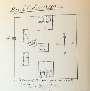
This tour will explore questions such as: What do the Odawa, Ojibwe, and Badawademi have to do with the founding of the University? How did the Diag change from pasture to the tree-covered expanse it is today? Before the President’s House was the President’s House, what was it? Why is a plaque commemorating the admission of women located in Angell Hall?
This tour meets in front of Angell Hall and ends at the Detroit Observatory. Advance registration optional.
This tour meets in front of Angell Hall and ends at the Detroit Observatory. Advance registration optional.