All occurrences of this event have passed.
This listing is displayed for historical purposes.
Presented By: University Library
Places & Spaces: Mapping Science and A Brief History of Information Graphics


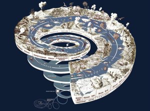
The Places & Spaces: Mapping Science exhibit introduces science mapping techniques and data visualization to the general public and to experts across diverse disciplines, and we hope inspires cross-disciplinary discussion on how to best track and communicate scholarly activity and scientific progress on a global scale. The exhibit includes a macroscope which showcases interactive visualizations that demonstrate the impact of different data cleaning, analysis, and visualization algorithms.
The Places & Spaces exhibit is curated by the Cyberinfrastructure for Network Science Center at Indiana University. The complementary exhibit, A Brief History of Information Graphics, was created by Clark Library staff to provide an historical context to the Places and Spaces exhibit.
The Places & Spaces exhibit is curated by the Cyberinfrastructure for Network Science Center at Indiana University. The complementary exhibit, A Brief History of Information Graphics, was created by Clark Library staff to provide an historical context to the Places and Spaces exhibit.
Back to Main Content
0 upcoming occurrences
0 expired occurrences
0 expired occurrences
When and Where
Map Hatcher Graduate Library - Clark Library (2nd floor)
August 2022
8:00am
- 7:00pm
8:00am
- 7:00pm
8:00am
- 7:00pm
September 2022
8:00am
- 7:00pm
8:00am
- 7:00pm
8:00am
- 7:00pm
8:00am
- 7:00pm
8:00am
- 7:00pm
8:00am
- 7:00pm
8:00am
- 7:00pm
8:00am
- 7:00pm
8:00am
- 7:00pm
8:00am
- 7:00pm
8:00am
- 7:00pm
8:00am
- 7:00pm
8:00am
- 7:00pm
8:00am
- 7:00pm
8:00am
- 7:00pm
8:00am
- 7:00pm
8:00am
- 7:00pm
8:00am
- 7:00pm
8:00am
- 7:00pm
8:00am
- 7:00pm
8:00am
- 7:00pm
8:00am
- 7:00pm
8:00am
- 7:00pm
8:00am
- 7:00pm
8:00am
- 7:00pm
8:00am
- 7:00pm
8:00am
- 7:00pm
October 2022
8:00am
- 7:00pm
8:00am
- 7:00pm
8:00am
- 7:00pm
8:00am
- 7:00pm
8:00am
- 7:00pm
8:00am
- 7:00pm
8:00am
- 7:00pm
8:00am
- 7:00pm
8:00am
- 7:00pm
8:00am
- 7:00pm
8:00am
- 7:00pm
8:00am
- 7:00pm
8:00am
- 7:00pm
8:00am
- 7:00pm
8:00am
- 7:00pm
8:00am
- 7:00pm
8:00am
- 7:00pm
8:00am
- 7:00pm
8:00am
- 7:00pm
8:00am
- 7:00pm
8:00am
- 7:00pm
8:00am
- 7:00pm
8:00am
- 7:00pm
8:00am
- 7:00pm
8:00am
- 7:00pm
8:00am
- 7:00pm
8:00am
- 7:00pm
8:00am
- 7:00pm
8:00am
- 7:00pm
8:00am
- 7:00pm
8:00am
- 7:00pm
November 2022
8:00am
- 7:00pm
8:00am
- 7:00pm
8:00am
- 7:00pm
8:00am
- 7:00pm
8:00am
- 7:00pm
8:00am
- 7:00pm
8:00am
- 7:00pm
8:00am
- 7:00pm
8:00am
- 7:00pm
8:00am
- 7:00pm
8:00am
- 7:00pm
8:00am
- 7:00pm
8:00am
- 7:00pm
8:00am
- 7:00pm
8:00am
- 7:00pm
8:00am
- 7:00pm
8:00am
- 7:00pm
8:00am
- 7:00pm
8:00am
- 7:00pm
8:00am
- 7:00pm
8:00am
- 7:00pm
8:00am
- 7:00pm
8:00am
- 7:00pm
1:00pm
- 7:00pm
8:00am
- 7:00pm
8:00am
- 7:00pm
8:00am
- 7:00pm
8:00am
- 7:00pm
December 2022
8:00am
- 7:00pm
8:00am
- 7:00pm
8:00am
- 7:00pm
8:00am
- 7:00pm
8:00am
- 7:00pm
8:00am
- 7:00pm
8:00am
- 7:00pm
8:00am
- 7:00pm
8:00am
- 7:00pm
8:00am
- 7:00pm
8:00am
- 7:00pm
8:00am
- 7:00pm
8:00am
- 7:00pm
8:00am
- 7:00pm
8:00am
- 7:00pm
8:00am
- 7:00pm
8:00am
- 7:00pm
8:00am
- 7:00pm
8:00am
- 7:00pm
8:00am
- 7:00pm
8:00am
- 7:00pm
8:00am
- 7:00pm
8:00am
- 6:00pm